
Free for the people of Jersey
Jersey's weather app, designed perfectly for Jersey.
Hour-by-hour forecasts from the Met Office 2 km model — rain, wind, UV, sea and St Helier tides, read for this island rather than averaged across a region. It even knows which beach is best right now.


Available now…or scan with your phone


Available now…or scan with your phone
As heard onChannel 103
with ❤️ from Pinkie & the Brain
What it does
A weather app that knows where it lives
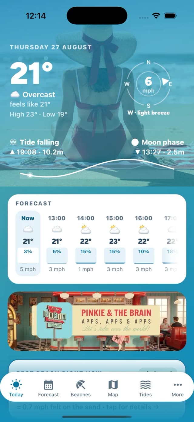
Open it for the forecast, the way you would any weather app. The difference is everything a global one can't tell you about this island — the tide, the sea, the bay that's sheltered today, and whether the causeway is still walkable.
Is the causeway still walkable?
Elizabeth Castle, St Aubin's Fort, Corbière and the Havre des Pas pool — whether the crossing is open right now, and the exact minute it closes. The thresholds are Ports of Jersey's own survey figures, not our estimates. Marina gates too, which work the other way round. And if the tide data looks wrong, it says so instead of guessing.
Rain radar you can watch move
The last two hours of rain over Jersey and the Channel, playing as a loop. You see the shower coming off the Atlantic while it is still out there — not once it is already on you.
Right now, in one screen
Temperature and feels-like, UV with sun-safety advice, wind and gusts on a compass, humidity, sunrise and sunset — then sea temperature and swell, because this is an island.
Rain, six hours ahead
Hour by hour, how likely it is and how much. Enough to know whether to get the washing in, walk the dog now, or give it twenty minutes.
The week ahead
Seven days of highs and lows, wind, UV and what the day actually looks like — tap any day to open its hour-by-hour timeline.
A 2 km island model, not a global average
We read the Met Office UKV 2 km model for Jersey, via Open-Meteo. The usual global blend runs a degree or two warm over the Channel Islands; ours matches the figures islanders actually check against.
Tides for St Helier
A 24-hour tide curve, next high and low water, and whether it's rising or falling right now — with proper respect for one of the world's biggest tidal ranges.
The best beach, right now
Every bay faces a different way. We read the live wind and rank all 18 of Jersey's beaches by shelter — and you can re-rank them for what you're actually doing: sunbathing, a walk, the dog, a surf, or a coffee.
The wind, drawn across the island
Live wind arrows over the whole map, coloured by strength on the same Beaufort scale the beach pages use — so which coast is sheltered today is something you see rather than work out.
How clean the water tested
The Government of Jersey's Environmental Health team samples sixteen bays every week through the season. We show their results unaltered, always with the date they were taken — and nothing at all for the bays they do not sample, because borrowing a neighbour's reading would be inventing a health claim.
The moon, and the fortnight's biggest tides
Tonight's phase and how full it is, plus the spring–neap outlook: when the biggest tides arrive, and with them the lowest water of the fortnight for fishing, rock pools and reef walks.
Wind, hour by hour, per beach
The island forecast only tells half the story. Open a beach to see the wind on that sand for the next 12 hours, and the list tells you when a bay turns sheltered or exposed — so this afternoon's pick needn't be this morning's.
The best window in the day
When to swim, when to walk the dog — the best hours in the next 24, scored on temperature, wind, rain, UV and the tide, each with a line saying why.
A guide to every bay
Lifeguard cover, dog rules that change with the season and the hour, parking, how hard the walk down is, and the rip currents worth knowing about before you swim.
Surf, when there's surf
On the surf beaches: rideable size from the live swell and period, whether the wind is grooming it or wrecking it, and an honest word when it's simply flat.
The whole island, mapped
Every bay on a live map — wind-shelter at a glance, plus public toilets, the nearest bus stops and which traders are out today. The island's tiles are cached, so the map still works down on the sand with no signal.
A nudge worth having
Opt in for a morning heads-up when it's genuinely a good beach day — plus optional warnings for big spring tides and strong winds. Nothing else, ever.
Trucks, cafes & shops on the sand
See which food trucks are pitched where today, which beach cafes and shops are open right now — and show the app to claim their specials.
Free, for Jersey
No tracking, no ad networks, no account needed. One advert at a time, never more. Built on-island, for the island.
Today — the weather at a glance
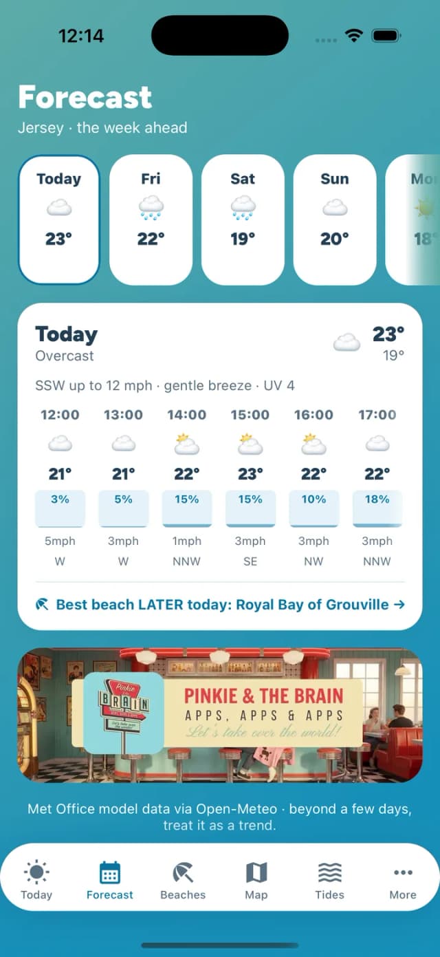
The week ahead, hour by hour
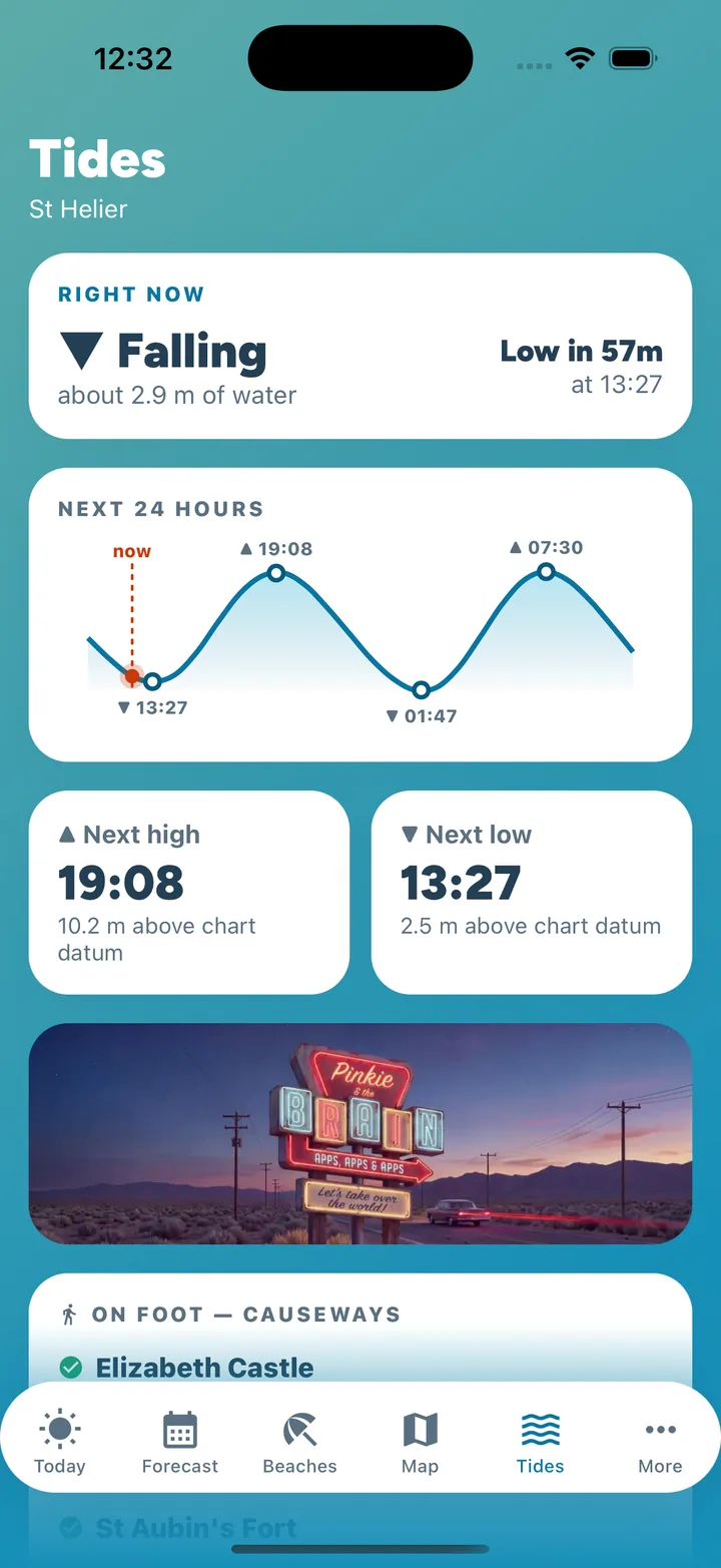
St Helier tide curve
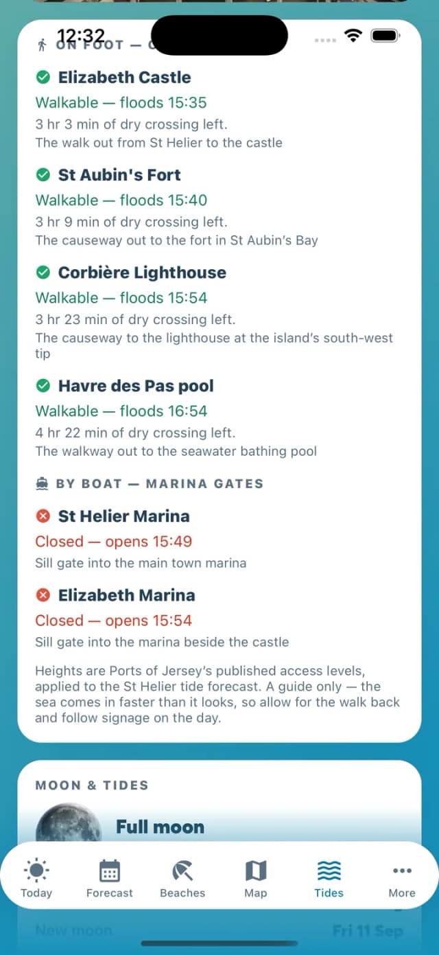
Which causeways are walkable, and until when
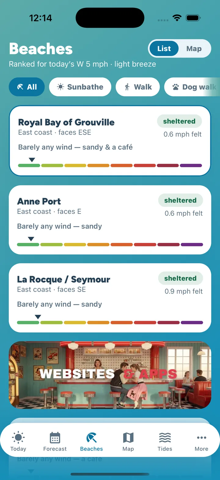
Beaches ranked by wind shelter
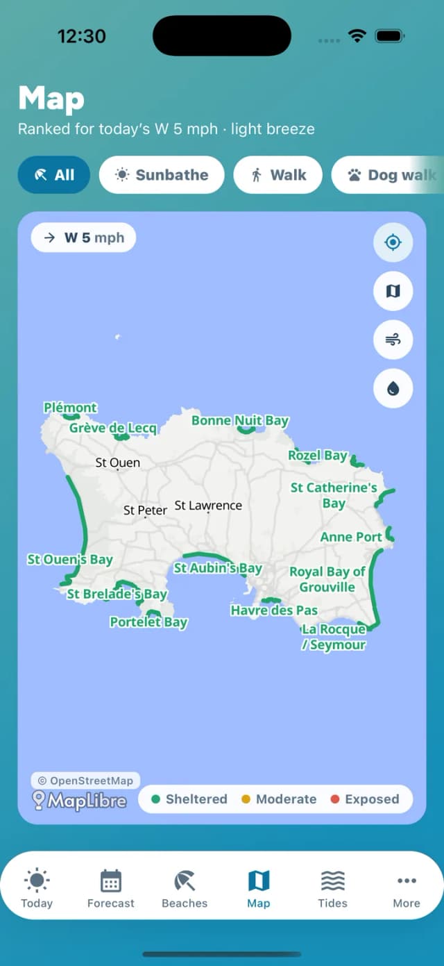
The whole island on one map
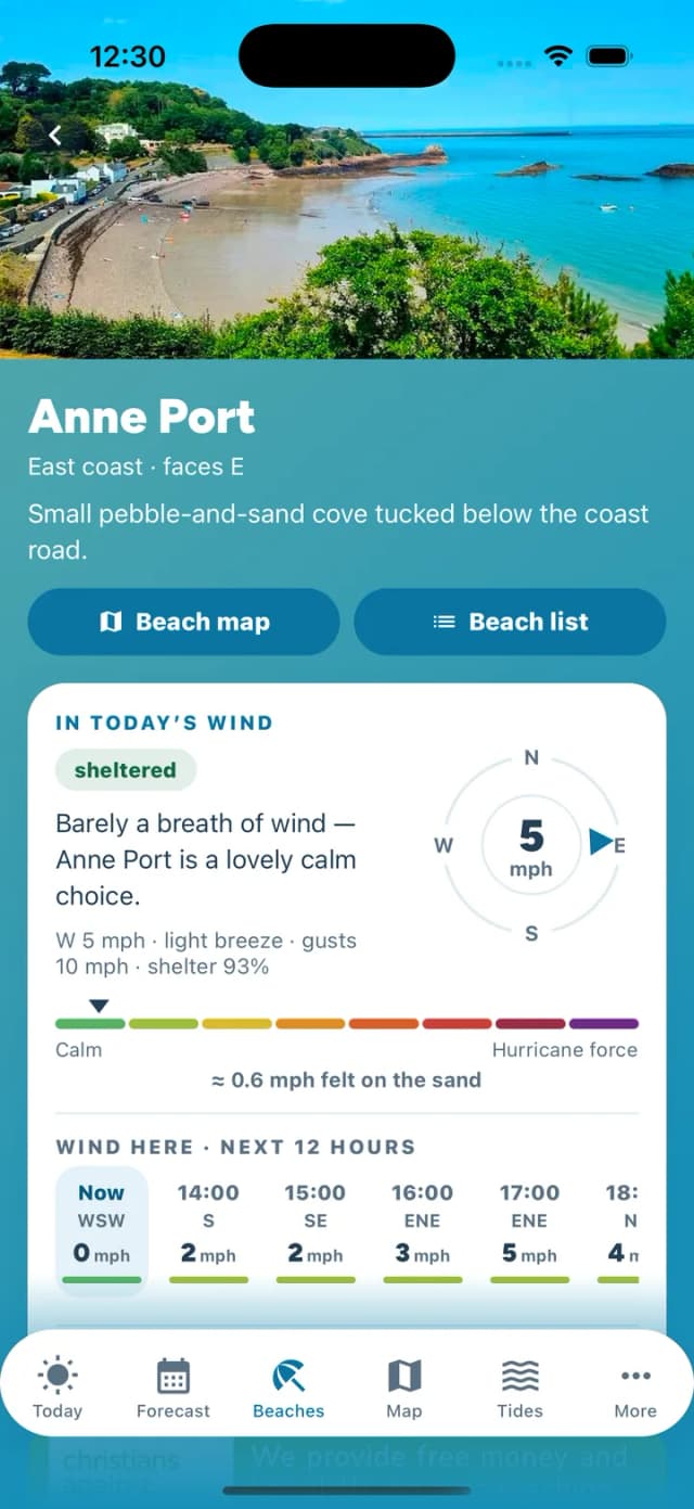
A beach guide page

Traders and advertisers start here
What people say
From the App Store and Google Play
As a pet owner, this app has helped me know when to take my dog for walks it soooo EASY to use and its so simple to find what you looking for it has everything for the tide times to when to walk your dog this app is amazing. you should definitely download now
Brilliant local app, everything for us beach lovers. thank you
Read every review on the App StoreSee the app on Google Play
Live from the beaches
On the sand today
Checking the beaches…
Run a food truck, beach cafe or shop?
Put your business on the island's beach map — FREE.
- Trucks post their daily spot; cafes, restaurants & shops list their beach and hours
- Appear in the app and right here on jerseybeachapp.com
- Add a special if you want to — customers claim it by showing the app
- Takes two minutes, works from your phone or right here
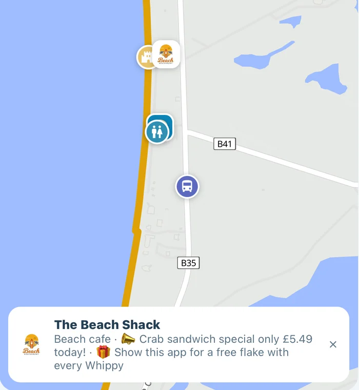

Text over background

Static image including text

Video

Got a Jersey business?
Be there every time the island checks the weather.
- People open a weather app most days of the year — not once a summer
- One partner card per screen, ever. Never more than 6 advertisers on the app
- Flat monthly pricing from £59. No auctions, no per-click
- The rate you start on is the rate you keep, for as long as you keep your slot
Who made this

Built in Jersey by Pinkie & the Brain
A solo studio crafting bespoke websites and apps for local businesses. This one's free — our love letter to the island. Fancy an app of your own?